Product Description
Macomb, John N. and Newberry, John S.; Report of the Exploring Expedition From Santa Fé, New Mexico, To the Junction of the Grand and Green Rivers of the Great Colorado of the West in 1859, under Command of Captain J. N. Macomb with Geological Report by Professor J. S. Newberry, Geologist. Washington: Government Printing Office, 1876. Quarto, pp. viii, 152, with 22 full page plates, including eleven chromolithographed plates, eight lithographed plates of fossils and three lithographed plates of landscapes and the large Baron F.W. Egloffstein folded map which measures 30 by 36 inches, "Explorations and Surveys in New Mexico and Utah. 1860" .
The work is complete and in the original brown cloth with gilt spine titles. The binding is tight and clean, spine titles slightly faded, rubbing to binding edges and corners. Stamp mark on title page with owner's name erased. Blind stamp of noted paleontologist Craig Black on outer corner of title page. The text, plates and map are bright and very clean. In very good condition.
Colonel John N. Macomb (1811-1889) was an American military officer and graduate of West Point He is best remembered for his 1859 expedition to the junction of the Green and Grand Rivers in Utah. Macomb’s expedition had military and political origins. Its primary purposes were to locate a route for the movement of military supplies from Santa Fé, New Mexico to Utah, and to map unknown portions of the geography in the western United States as well as to gain a better understanding of the geology of the region. Despite these missions, as the explorers traveled the Old Spanish Trail, collectors like geologist and botanist John S. Newberry (1822-1892) had ample time to study the environment. The expedition went west from Santa Fe across northern New Mexico and Arizona to the Colorado. The party explored the mountains and tributaries of the San Juan River and the Rio Navajo tributary. Newberry made a side trip to find the junction of the Grand and Green Rivers and mapped the region in detail. His work was to lead to the production of the Egloffstein map which is considered one of the most beautiful maps ever produced by the U. S. Army.
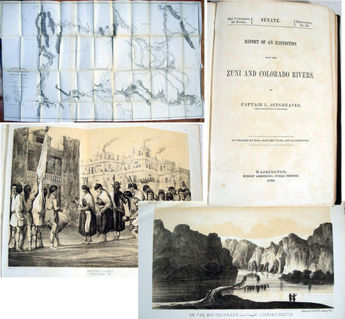
In June 1859 Capt. John N. Macomb, chief topographical officer in New Mexico, was ordered to lead an expedition northward along the Old Spanish Trail in search of the desired military road into Utah. Twenty thousand dollars was appropriated for the expedition, and Macomb was authorized to take along John Strong Newberry. The expedition made its way toward the junction of the Green and Grand rivers. At one point their view swept across a wide expanse of the country and Newberry wrote that it was "everywhere deeply cut by a tangled maze of canyons, and thickly set with towers, castles, and spires of the most varied and striking forms; the most wonderful monuments of erosion, which our eyes, already experienced in objects of this kind, had ever beheld". Macomb's geographical report was initially to be issued without Newberry's geological report but publication was delayed for 15 years by the the Civil War, allowing time for Newberry's contribution to be included. Newberry was able to establish numerous stratigraphic columns, and to trace the Triassic, Jurassic, and Carboniferous strata far out across the Colorado River. Newberry introduced a new level of sophistication into the study of western geology. The plates depict the various canyons and rivers the expedition encountered, as well as eight geological plates. The folding map, measuring 30 by 36 inches, "is one of the most beautiful ever published by the army". Like Ives maps it was done by Baron F.W. Egloffstein. Again he speaks of the Big Cañon of the Colorado River, thus making it clear that the term Grand Cañon had not yet emerged.


